Mapping and orthomosaic
A measurable map of the site, not just a picture of it.
Orthomosaics, elevation models, point clouds and volumes for surveyors, engineers, earthworks contractors and site teams. Captured with ground control to the accuracy you specify.
Canada-wide · Transport Canada Advanced RPAS · Commercially insured
Quantities you can invoice against, from data you can check.
This is for surveyors, civil engineers, earthworks and mining contractors, and site managers who need measurements from a site, not just images of it. Stockpile volumes, cut and fill, as-built surfaces, a current base map for design.
Walking a site with a GPS rover gives you a few hundred points a day. Estimating a stockpile by eye gives you an argument at the next progress meeting.
A drone survey with ground control gives you millions of points in an hour, a map every person on the project can measure on, and a surface model that turns earthworks quantification into arithmetic. The accuracy is stated and checked, so your surveyor can stand behind it.
Quantities
Stockpiles and cut and fill
Volumes computed from the surface model, not from a walk-around estimate. Repeat monthly and the earthworks progress is a number.
Site intelligence
One current map
A georeferenced orthomosaic the whole team can measure on, overlay design drawings on, and mark up for the next OAC meeting.
Design and as-built
Compare to the plan
Surfaces and point clouds in your CAD or GIS, so built conditions sit on top of design and the differences are obvious.
Deliverables
What you get
Orthomosaic
A georeferenced, distortion-corrected top-down image of the site, stitched from hundreds of overlapping photos. GeoTIFF at the ground sample distance (GSD, the size of one pixel on the ground) you need, typically 1 to 3 cm.
DSM and DTM
Digital surface model (everything, including stockpiles and structures) and digital terrain model (bare ground), as GeoTIFF rasters.
Point cloud and mesh
Dense point cloud in LAS or LAZ, and a textured 3D mesh where you want it, in your coordinate system.
Volumes and cut and fill
Stockpile volumes by pile and cut and fill against a design surface or a previous capture, as a report and a surface.
Contours and CAD exports
Contours at your interval, breaklines where surveyed, DXF or DWG exports.
Accuracy report
Ground control point layout, checkpoint residuals and the achieved accuracy, so your surveyor can sign off on it.
- Turnaround
- Agreed at scoping; processing time scales with site size and deliverable set
- Delivery
- Shared folder in your coordinate system, or straight into your platform
- Licensing
- You own every file, for any use.
What it looks like
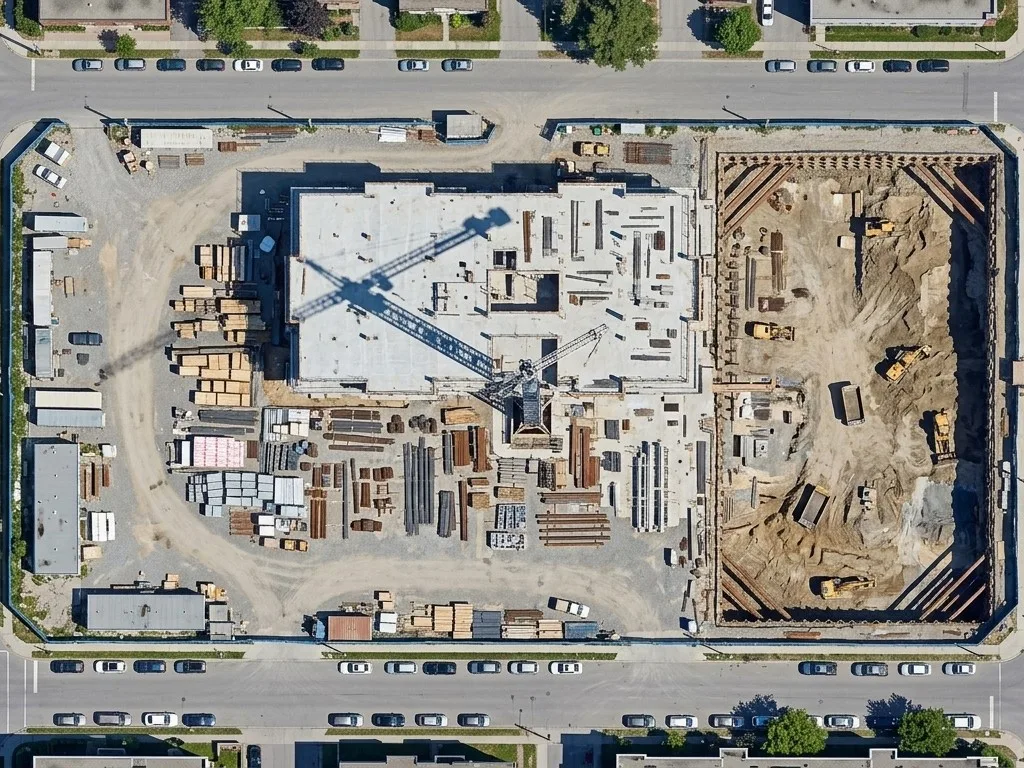
Orthomosaic
Georeferenced and distortion-corrected. Measure on it, overlay design on it, share it.
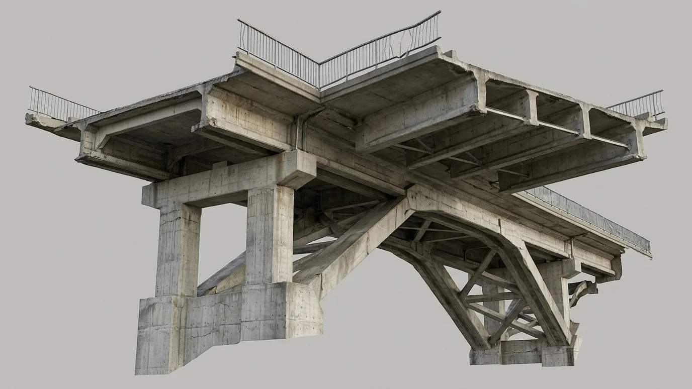
Textured 3D mesh
Built from the same photos. Structures and slopes reviewed in context, in a browser.
How it works
Ground control first, then everything else.
Accuracy comes from the ground, not the drone. The flight is the easy part.
Scoping call
Area, required accuracy and GSD, coordinate system, deliverables, and whether your surveyor is placing control or we are.
Ground control
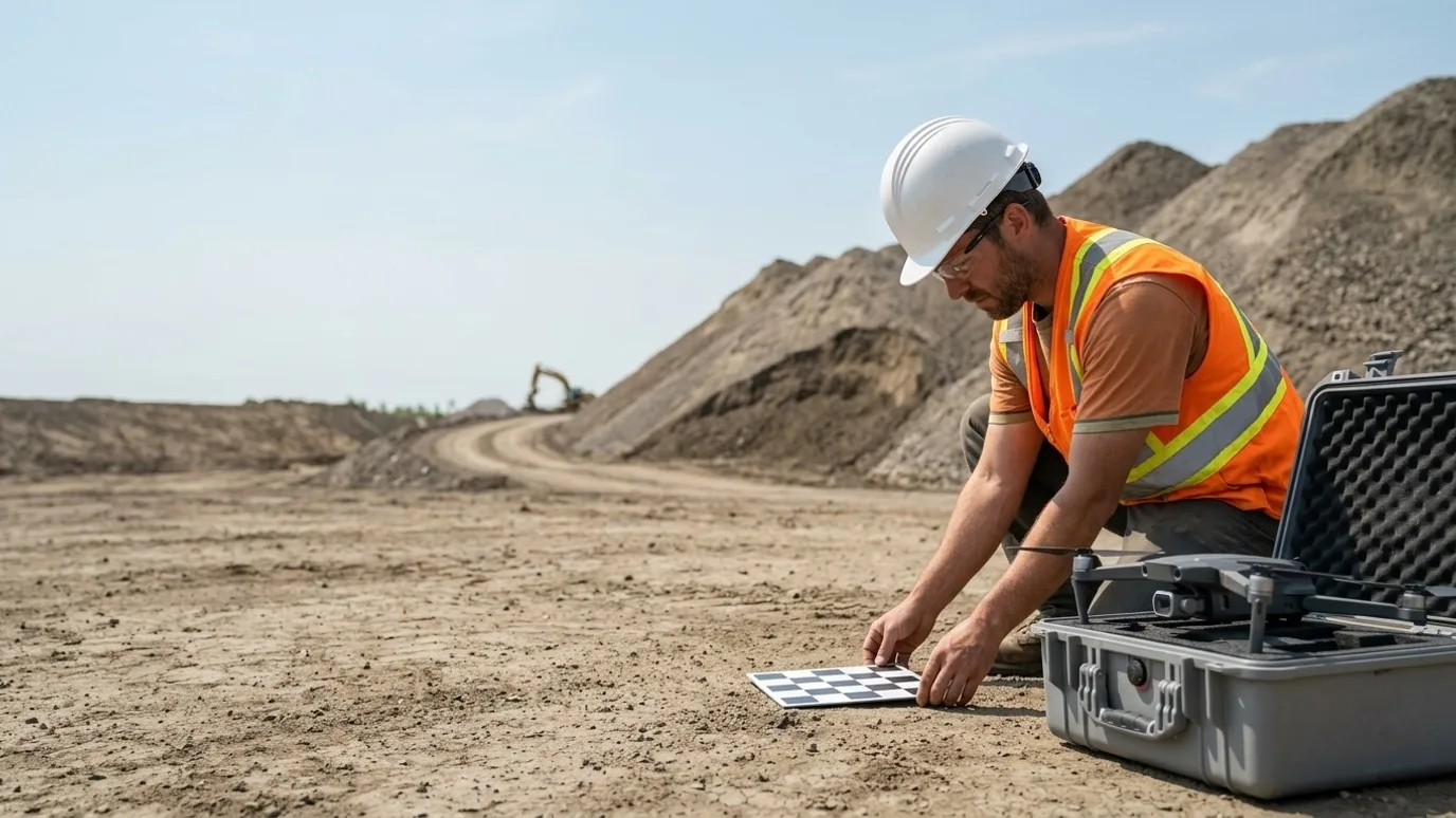
Targets placed and surveyed across the site (ground control points, the known coordinates that tie the map to the real world), plus independent checkpoints.
Capture
Grid flight at the planned altitude and overlap. Oblique passes added where structures or steep slopes need them.
Processing and QA
Photogrammetric processing, checkpoint verification, deliverables exported in your system, accuracy report included.
01
Scoping call
Area, required accuracy and GSD, coordinate system, deliverables, and whether your surveyor is placing control or we are.
02
Ground control
Targets placed and surveyed across the site (ground control points, the known coordinates that tie the map to the real world), plus independent checkpoints.
03
Capture
Grid flight at the planned altitude and overlap. Oblique passes added where structures or steep slopes need them.
04
Processing and QA
Photogrammetric processing, checkpoint verification, deliverables exported in your system, accuracy report included.
Compliance
Compliance, in plain terms
Nothing here is a selling point. It is the minimum you should demand from anyone who flies on your site.
Transport Canada Advanced RPAS certificate
The advanced certificate is the one that permits flight in controlled airspace and near people. Every operator Lensdrone dispatches holds it.
Commercial liability insurance
Insured for commercial RPAS operations. Certificate of insurance available on request, naming your company where required.
NAV CANADA airspace authorisation
Controlled airspace near airports needs authorisation before each flight. We handle the request and build the lead time into scheduling.
SFOC where needed
Some operations, such as flights over 122 m or beyond visual line of sight, need a Special Flight Operations Certificate. We tell you up front if your job needs one and manage the application.
Site safety briefing
We attend your site orientation, follow your PPE and access rules, and brief your team on where and when we are flying.
Pricing
Quoted per project. Tell us about the site and you get a scope and a number.
What moves it
- Area
- Required GSD and accuracy
- Ground control points
- Deliverable set (ortho, DSM, DTM, point cloud, mesh)
In practice
What it looks like on a real job
Earthworks contractor
Monthly quantities on an earthworks contract
- The problem
- Monthly progress payments were being argued over because the quantities came from a rough site walk.
- What we captured
- Monthly orthomosaic and DSM with ground control, cut and fill against the design surface, stockpile volumes by material.
- What changed
- Quantities went from a debate to a report both sides could check. Payment certification got faster.
FAQ
Questions people ask before booking
What accuracy can you achieve?
With surveyed ground control, horizontal accuracy in the range of one to two times the GSD and vertical around two to three times, which on a typical flight means a few centimetres. Without ground control, expect metres, which is fine for a picture and useless for volumes. We always say which one you are getting.
Do we need our own surveyor?
If the deliverable will be relied on for payment or design, having your surveyor place or check the control is the right call, and we work to their control. For internal tracking, we can place and survey the control ourselves.
Can we get the data in our coordinate system and software?
Yes. UTM, MTM, or a local site system. Exports for Civil 3D, Trimble Business Center, ArcGIS, QGIS, Carlson, and any platform that reads GeoTIFF, LAS and DXF.
How often should we map an active earthworks site?
Monthly is the usual rhythm for progress and quantities. Weekly on fast-moving sites or when a dispute is likely. The first capture is the baseline; every one after it is a comparison.
Does this work with DroneDeploy, Pix4D or Propeller?
Yes. If your team already lives in one of those, we fly to its spec and deliver into your account. See flights for your platform.
How big a site can you map?
From a single lot to several hundred hectares in a day with the right aircraft. Larger corridors are flown in sections or under a beyond visual line of sight authorisation.
Next step
Tell us about the site.
Anywhere in Canada. Send the basics and Ben will come back as soon as he can with a scope and a price. If you would rather talk, call.
- Call Ben
- +1 778 889 9306
- Ballpark in 60 seconds
- Instant estimate